November 30th - December 1st - 2006
Winter Storm Chase
General Storm Evolution | Daily Highlights |
Snowfall Total Maps |
Satellite Imagery
Radar Animations |
Satellite Animation |
Jet Stream Animation
Wednesday | Thursday |
Friday |
| |
|
| Return Home |
| Return to Analysis
Page |
| |
|
Historic Winter Storm Event |
|
|
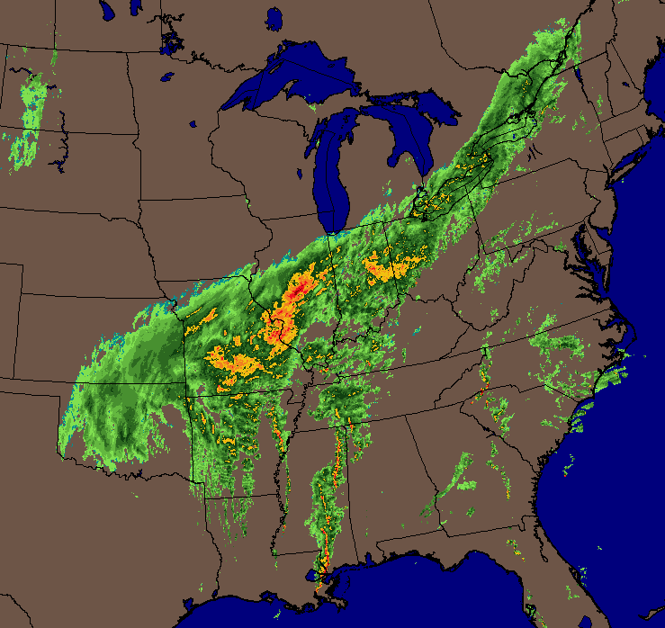
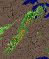
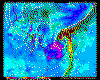
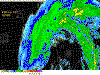
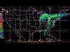
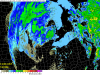
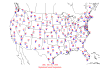
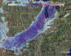
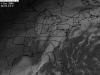
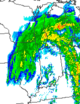
Eastern United States Composite Radar
WeatherTap Image |
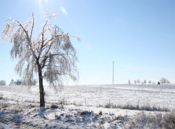
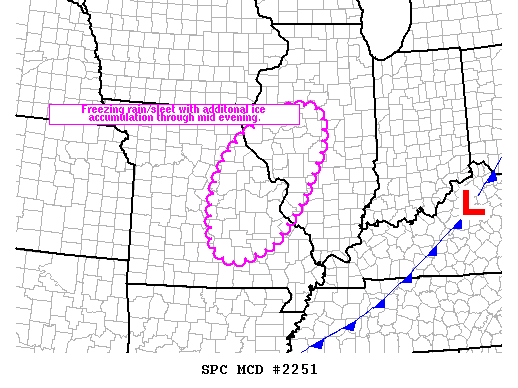
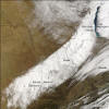
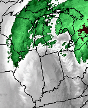
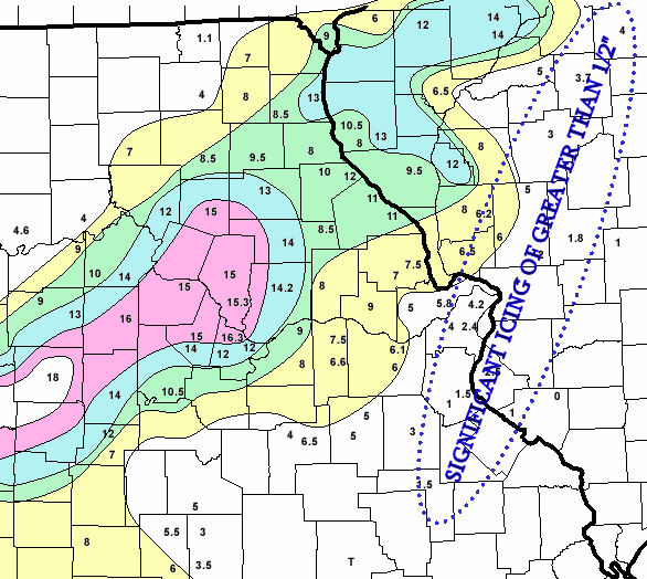
Heavy Ice Accumulation
Central Illinois |
|
| |
Chase Target: Peoria, Illinois
Arrival Date: November 30th at 2:30 a.m.
Driving Time: 5 1/2 Hours
Miles Traveled: 600+
Chase Rating  |
| |
| |
|
Chase Forecast: |
| |
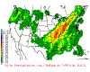
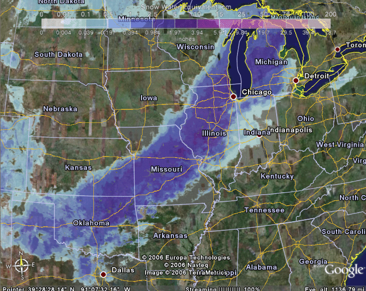
| The winter storm of late November and Early December of 2006 will not soon be
forgotten. Record or near record snow accumulations were reported across
portions of Oklahoma, Missouri, Illinois, and Wisconsin. Many areas
witnessed a long duration precipitation event. Thunderstorms were reported
with snow, sleet, and freezing rain across portions of Oklahoma, Missouri, and
Illinois.
I made the decision to chase this snowstorm at the last minute. Driving to
this event would be exciting, but I should also point out the challenges
involved: heavy rain, thunderstorms, temperatures falling to freezing,
18-wheelers trying to get ahead of the frozen precipitation, and it was night.
Nevertheless, I felt it would be worth the effort. I started
watching the potential winter storm two weeks before the event. My
first call map (additional
forecast map on day 3) was issued on Friday, November 24th. There was a
time, during the evolution of model forecasts, that it appeared my region
might even see some appreciable snowfall. In the end that would not
happen. On Wednesday, November 29th, I made the decision to chase this
storm. I guess my snow-deprivation had reached a critical point.
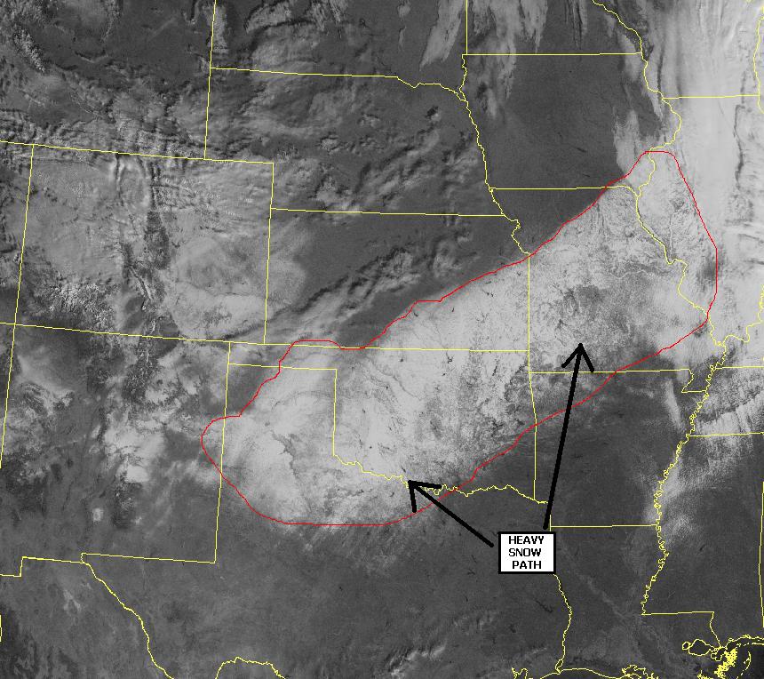
After reviewing the 00z model data suite, I decided that the heaviest snow
band would likely be from Southwest Missouri to Northeast Illinois. There would also be a band of
heavy ice/freezing rain on the southern
portion of the forecast area. Computer models indicated that snow totals could
exceed 18 inches in some locations. I expected a general 8-12" area across
portions of Central Illinois. This seemed a bit more reasonable than what
the models were forecasting. I also made a note that ground temperatures
were in the 40s across much of the above mentioned areas. My experience
though has been that ground temperatures will not matter in a heavy snow event.
Although models showed the heaviest snow band a tad to the northwest of the
Peoria area, I felt like the storm might track a bit further to the east and
south. I knew there would be a sharp cutoff area where little or no
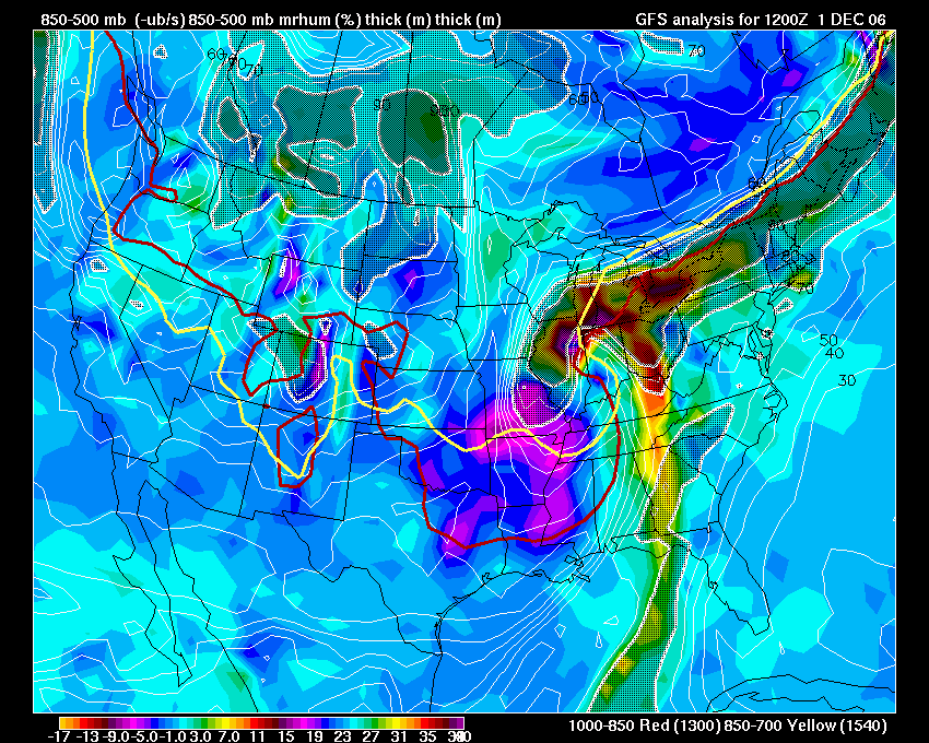
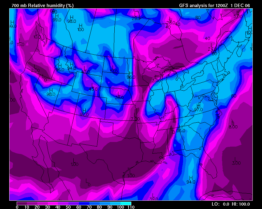
snow would fall. RH values at 700mb indicated that a
sharp dry slot would be cutting up through Southern Missouri, Illinois,
and Indiana on Friday Morning. I was a bit concerned about this
reaching into Central Illinois. I was looking for an area that would
have easy access to the interstate. I had decided on six potential
chase cities, however, only one could be chosen. In the end I would
decide on
Peoria, Illinois.
I believed three things: that this situation, no matter what the ground
temperature, would produce heavy snow accumulations; that the chase target
city would likely receive enough snow to approach their record one day
snowfall; and that Peoria, which is centrally located, would provide a nice
location to photograph the storm. The effort put into this storm system was
ultimately worth it: the chase (this time around) was a success!
|
|
|
|
|
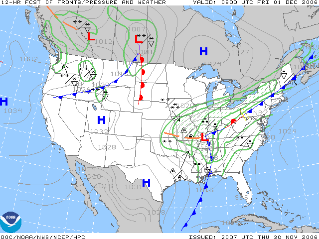
Forecast Surface Map
Thursday Night |
Forecast Surface Map
Thursday Night |
Forecast Surface Map
Friday Morning |
 Forecast Surface Map
Friday Afternoon |
|
|
|
|
|
|
|
Wednesday, November 29th.
Departure Day.
We left for Peoria between 8 p.m. and 9 p.m. on Wednesday Night. We had a
five to six hour drive ahead of us. It was already dark and rain was expected north of Mt
Vernon. I wondered just how long the drive might take because of worsening
weather conditions further north. Ice was already being reported across
portions of Northeast Missouri. Temperatures were also starting to fall in the Illinois
Counties bordering Missouri.
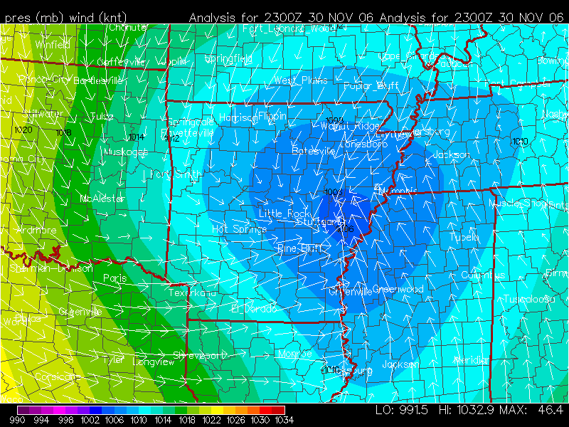
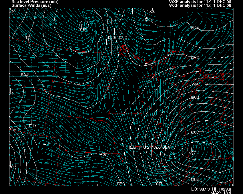
A strong cold front was positioned just to
the west/northwest of the Paducah,
Kentucky (KPAH) Region. At 8 p.m. the front was
entering Western and Central Illinois and then extended back into Central Missouri.
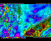
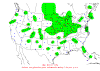
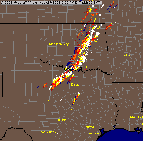
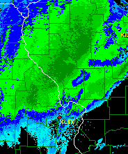
Radar indicated that this storm system was producing heavy rain/thunderstorms across a large portion of Oklahoma, Missouri, and Illinois.
Rainfall totals exceeded three inches in some locations. Flash flood warnings
were issued for a number of counties because of rapid runoff. Thankfully
we only had to drive through 30 minutes of heavy rain and that was near
Mattoon,
Illinois. I observed thunderstorms near Mattoon around 1 a.m. There
were four flashes of lightning to the northeast of the city. We
encountered a brief period of heavy rainfall as we crossed behind the cold
front. Winds gusted to around 30 mph as the front passed.
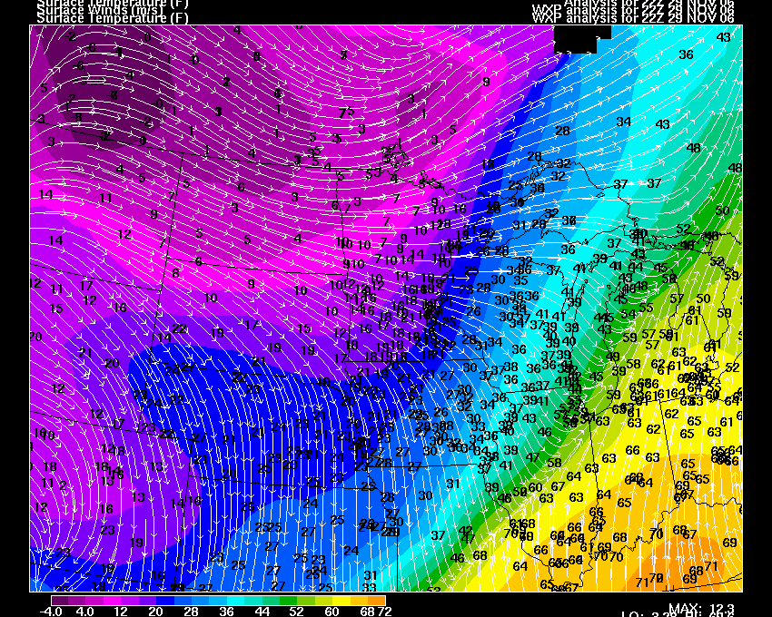
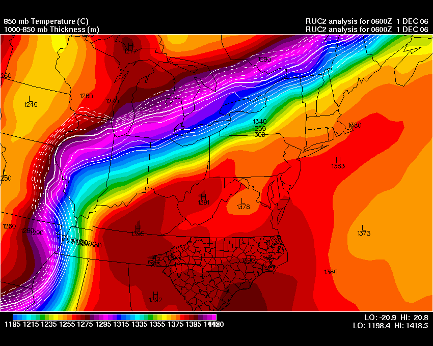
Temperatures then fell rapidly behind the arctic front. From
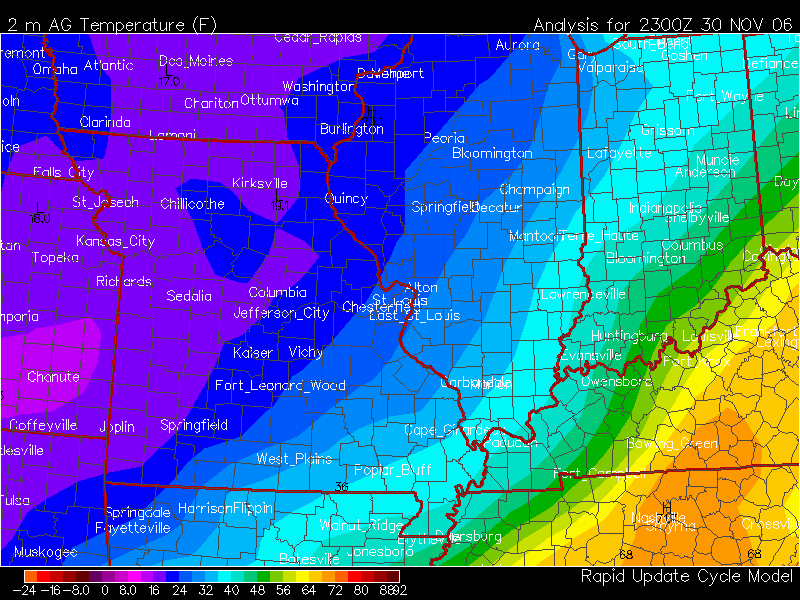
Mattoon to Peoria (approximately 100 miles) the temperature fell
30-35 degrees. Temperatures fell 15 degrees within just a
few minutes of frontal passage (see temperature gradient map below).
I made the decision to stay near the
Illinois River at the
Holiday Inn City Center. It was already almost 3 a.m. in the morning
when we pulled into Peoria. By the time we arrived at the hotel the outside
temperature had fallen to 32 degrees. I did a final check, before going to bed,
on area forecast discussions and model forecasts. My final forecast
appeared to be on target. Heavy snow would likely begin, after a period of
ice, on Thursday Night and continue into Friday Morning. Eight to twelve
inches of snow appeared likely for the City of Peoria. Sometimes, though,
warm air gets pulled into these storm systems a bit more than expected. So
my only concern was how much ice would fall on the front end of the
precipitation shield.
On a side note I discovered that the main weather forum, that I post in, had a
number of posters from the Peoria, Illinois area. It was nice to be able
to hear their reports and compare notes as the storm approached.
|
| |
 |
|
Wednesday Evening Temperature Map. |
|
 |
|
7:30 p.m. Weather Radar
WeatherTap |
|
 |
|
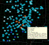
Wednesday Evening Lightning Data. |
|
 |
|
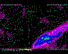
Wednesday Evening IR3 Satellite |
|
|
| |
| |
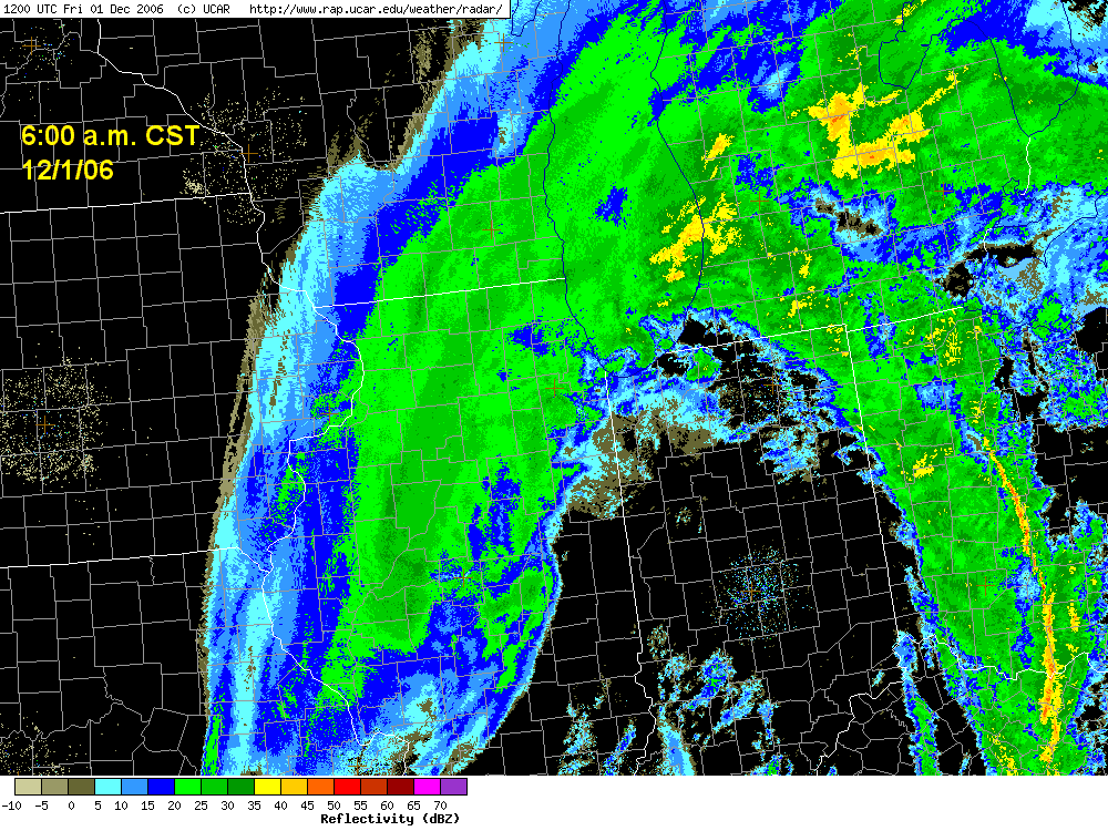
Thursday, November 30th.
I don't know how many of you have tried to sleep the night before a big
snowstorm but it isn't easy. I guess I am worse than a kid wanting to get
out of school. Nonetheless, I did get a few hours of sleep. Most of the 30th was
cloudy and dry. Precipitation would remain to our southwest
and south until late afternoon. The main surface low was still located over
Southern Arkansas at mid-day. A strong trough was approaching the Illinois
River Valley from the Plains. This coupled with strong low level cold air
advection and elevated warm air advection (as the low strengthened and was
pulling northeast) and a frontal system to our east and southeast was setting
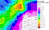
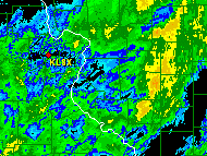
the stage for a wintry afternoon and evening. There was a rapid expansion of radar
returns after 4 p.m. Sleet and freezing rain began to fall in Peoria soon
after dusk. Soundings at KILX indicated that temperatures near the surface
were at or below freezing while temperatures were much warmer aloft (see
KILX sounding). For most of the evening the precipitation would
remain in the form of sleet with some occasion flakes of snow.
There was also a brief period of freezing rain. Thundersleet was observed
in Peoria on
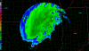
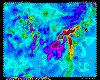
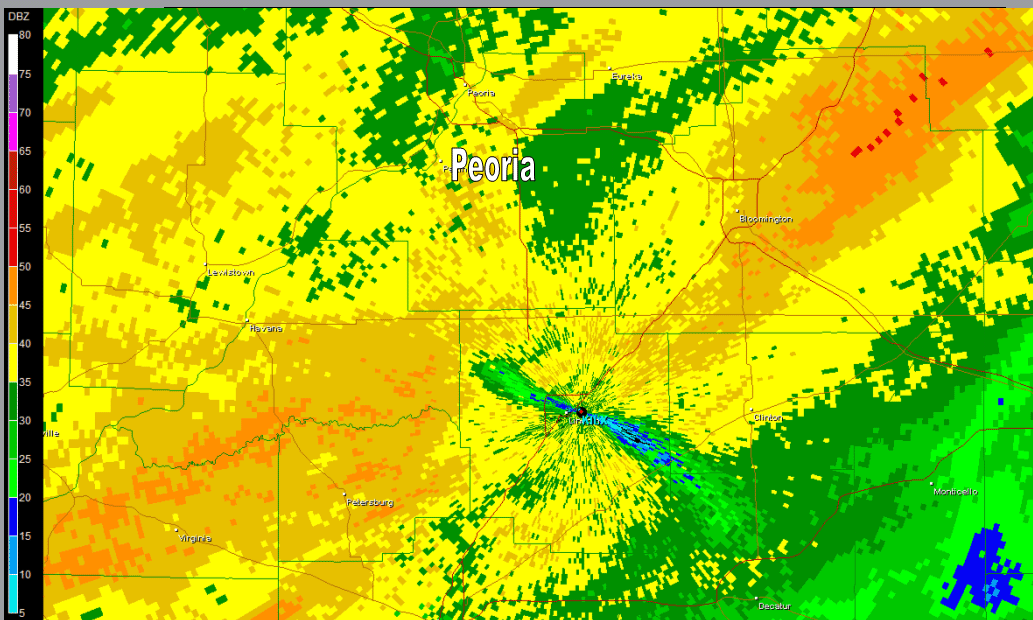
several occasions between 11 p.m. and 1 a.m. KILX radar showed
several
bands of high dbz levels moving over Peoria. These bands produced
heavy sleet and occasional lightning.
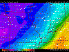
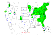
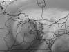
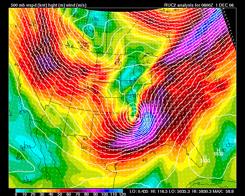
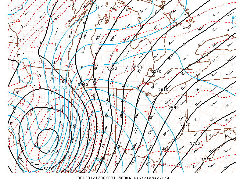
The 500mb low at 00z on Thursday Evening was over Eastern Oklahoma.
National Composite radar showed a rapidly expanding area of precipitation over
most of the Missouri Valley. The 500mb low would strengthen and track from
Southern Missouri into East Central Illinois and West Central Indiana (see maps
below). Strong wind fields were noted across much of the TN and Ohio
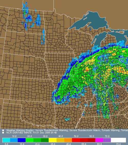
Valley Region. This would help fuel severe
thunderstorm development overnight on Thursday and into Friday Morning. A
number of severe weather events were
reported across the Ohio Valley (this would eventually spread into the
Northeast United States).
I spent much of my time going back and fourth from the hotel room to the
streets below. Although the sleet wasn't providing the most exciting photo
opportunities there were a few shots of city workers clearing streets. The
sound of the sleet against the hotel room window was fairly impressive.
Occasionally the wind would gust and cause a roaring noise. Moderate to
heavy sleet fell for more than five hours. It appeared that we had
received around 3 inches of ice/sleet. I knew that once we didn't hear
the sleet on the window that the sounding had grown cold enough for snow.
This wouldn't happen until the wee hours of the morning.
Exhausted, I finally decided to get a couple of hours of sleep from 3 a.m.
until 4:30 a.m. I awoke several times and was able to see heavy snow
falling outside the window. Sleep would not last long! |
| |
 |
|
6 p.m. Temperature Map for Missouri and Illinois |
|
 |
|
6 p.m. Mississippi Valley Surface Pressure Map |
|
 |
|
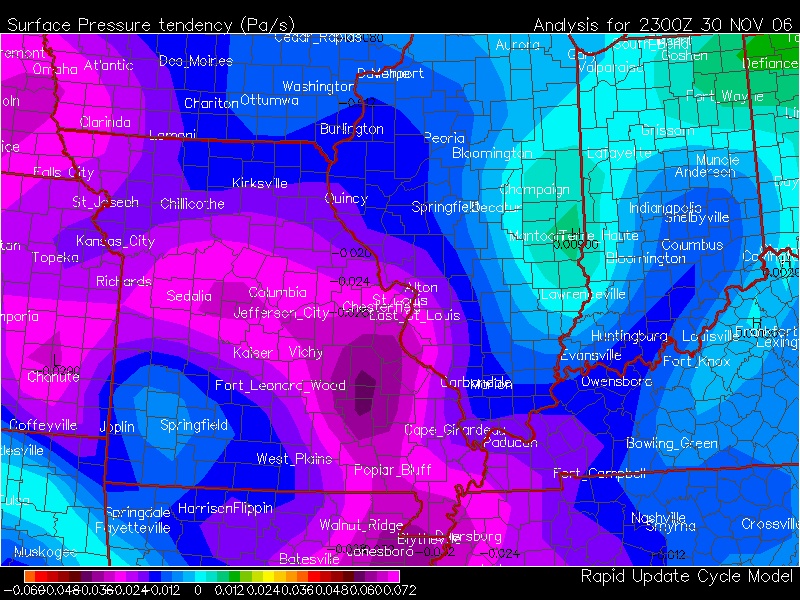
6 p.m. 3 Hour Pressure
Tendency Map |
|
 |
|
6:15 Central Illinois Radar showing Precip moving in |
|
|
| |
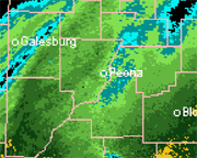 |
|
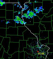
Peoria Radar Animation
Thursday 6:15 p.m. |
|
 |
|
Peoria Radar - 8:20 p.m. Thursday Evening. |
|
 |
|
Peoria Radar - 9 p.m. Radar Thursday Evening |
|
 |
|
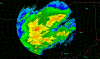
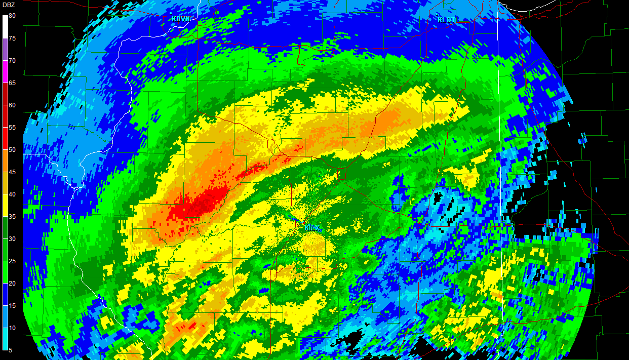
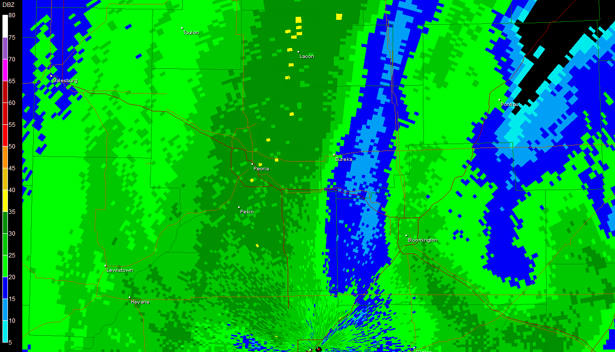
9:15 p.m. Bright Banding over Central Illinois |
|
|
| |
 |
|
9:15 p.m. Bright Banding over Peoria |
|
 |
|
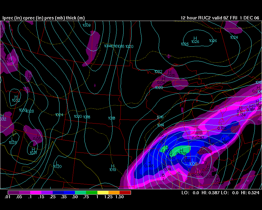
RUC Evening Surface Forecast Map |
|
|
|
|
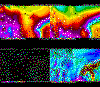
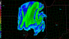
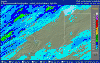
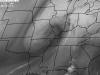
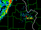
10:15 Central Illinois NWS Radar |
|
 |
|
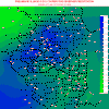
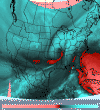
G.R. Storm Reports Map Missouri and Illinois |
|
|
| |
| |
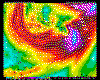
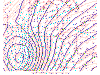
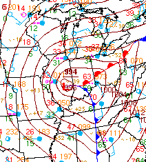
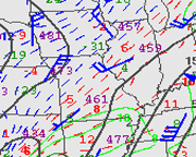
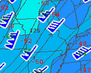
| November 30, 2006 - Upper Air Analysis |
| |
|
|
| |
|
|
| |
| |
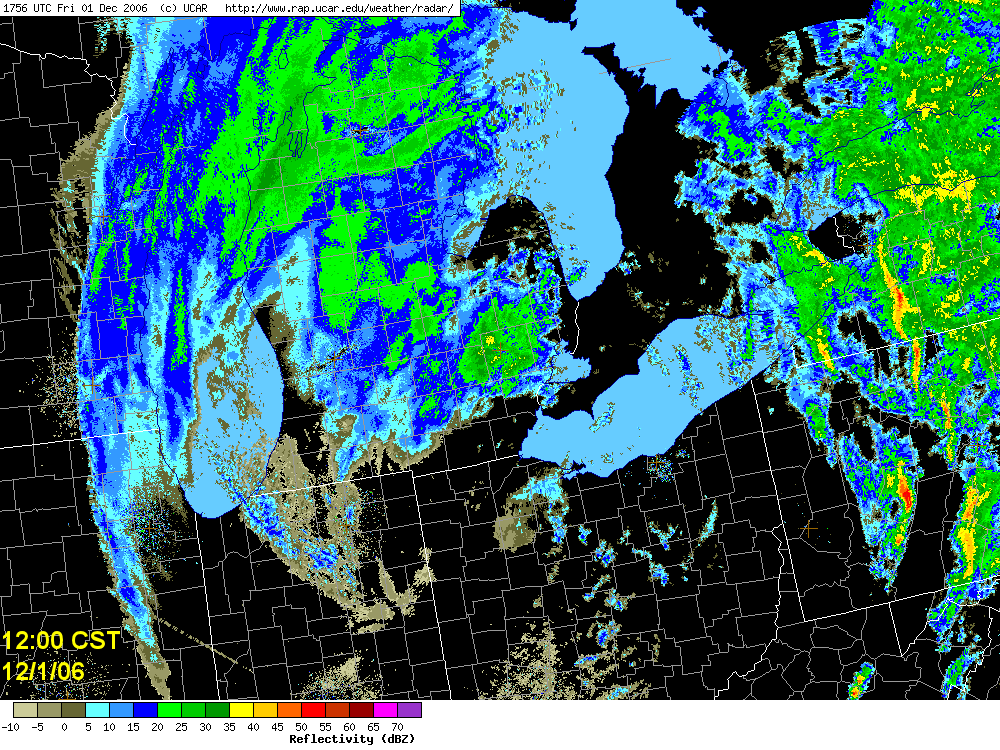
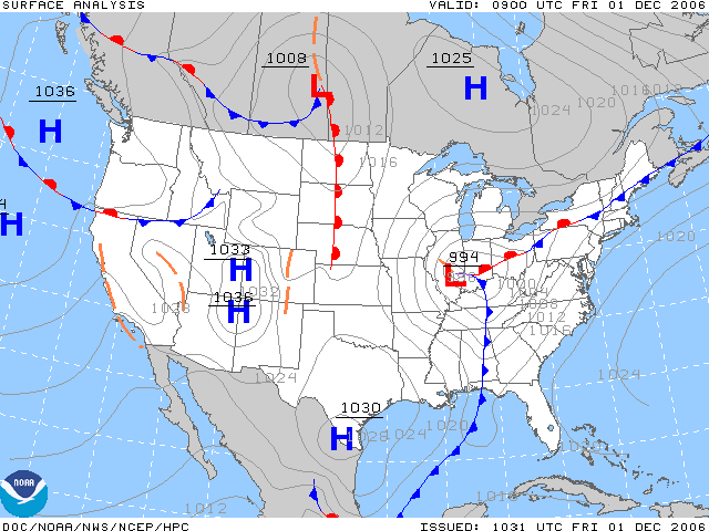
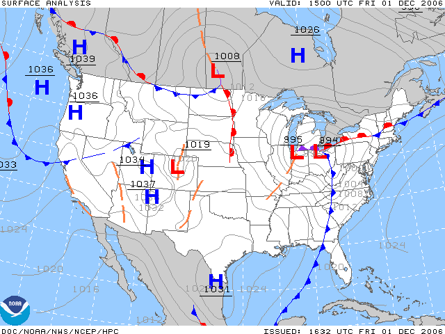
Friday, December 1st (the main
event)
The significant part of this winter storm began in earnest during the early
morning hours of December 1st. As mentioned above, Peoria had moderate to heavy sleet during
most of the early to middle portion of the night. Eventually enough cold air filtered in aloft to
change all the precipitation in Peoria to snow (see
morning soundings). This was after 2-3 inches of sleet had already
fallen. Once the precipitation changed to snow it remained snow through the
mid-morning hours. During the early morning hours thundersnow was reported across
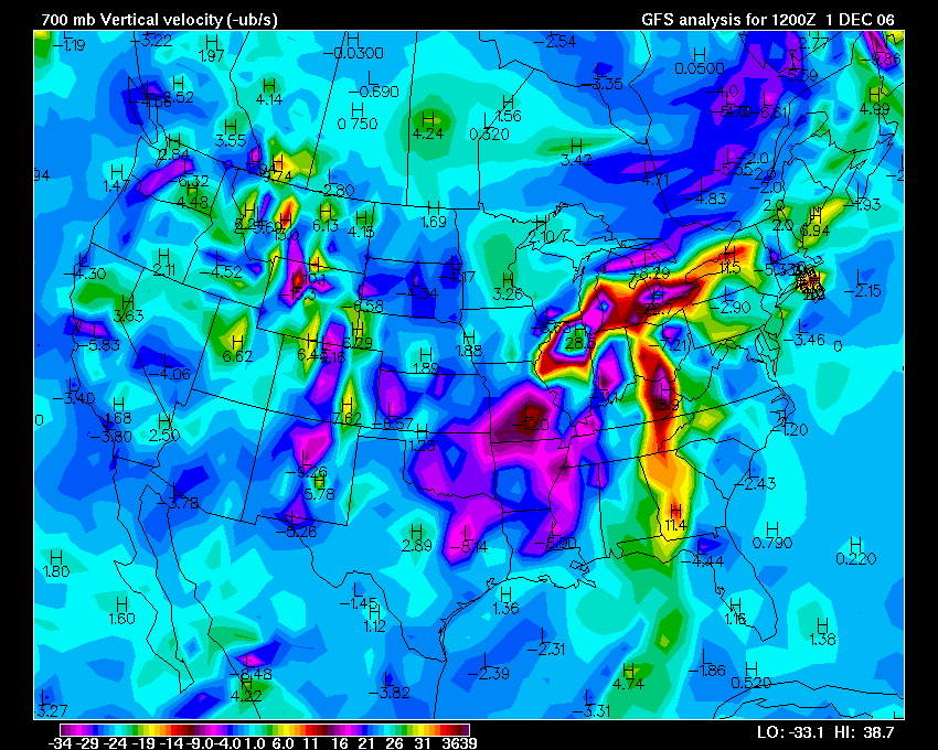
portions of Central Illinois (also portions of Oklahoma and Missouri). Strong Vertical Lift was noted on the model forecasts prior to
this event. Thundersnow was placed in my forecast as early as
Monday/Tuesday.
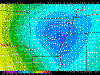
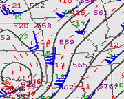
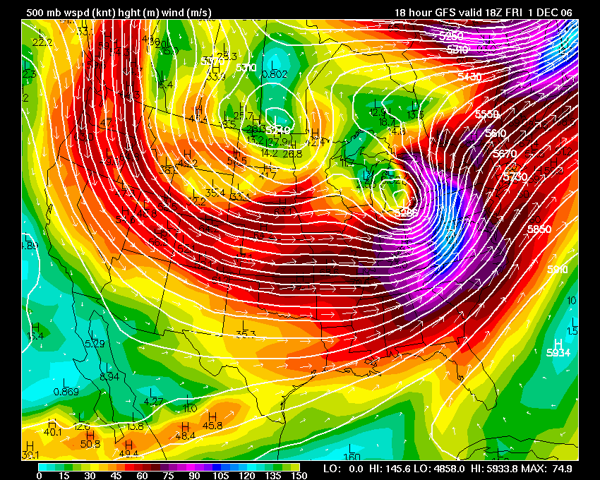
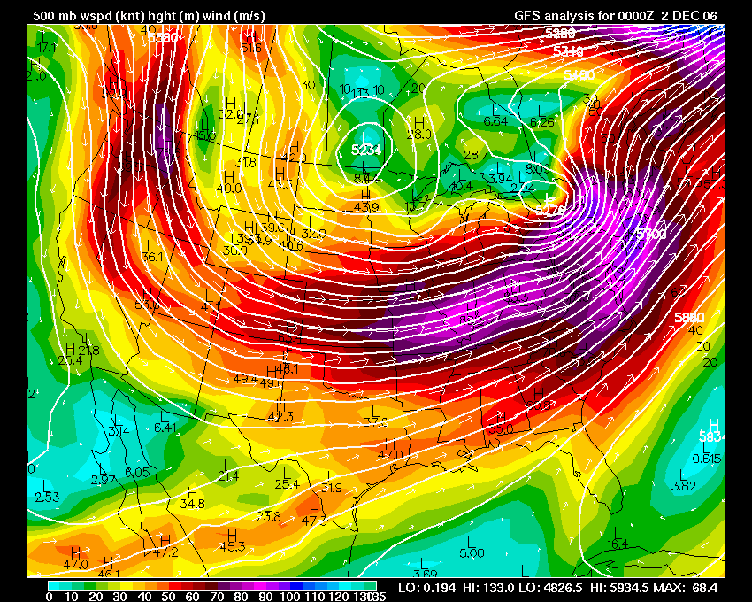
At 6 a.m. Friday, December 1st a strong 500mb shortwave was
located over Missouri and Illinois. This shortwave was strengthening and
moving east/northeast. (see charts below).
Heavy snow and thundersnow developed on the north side of this 500mb low during
the overnight hours.
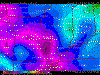
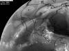
There was an abundance of jet stream energy available to pull up moisture, from
the Gulf of Mexico, into
the Arctic Air (See
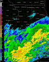
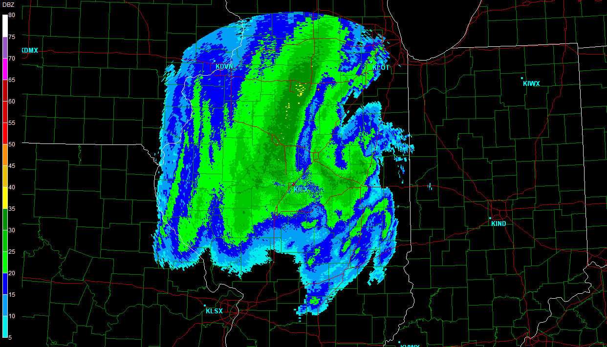
jet stream animation). Snow rapidly expanded and spread into Illinois during
the overnight hours of the 30th. By Friday Morning, December 1st, much of
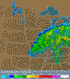
Central and Northern Illinois was covered in moderate to heavy snow. The
primary low was located near Champaign, Illinois at 6 a.m. This put the
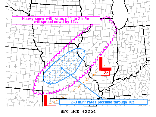
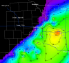
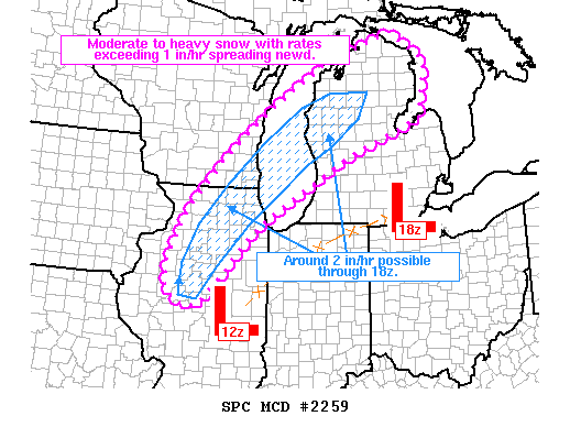
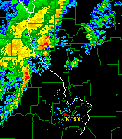
deformation zone over the Peoria area. Snowfall rates of 1-2 inches per hour were reported in some locations.
I observed heavy, wind
driven, and fine size snowflakes from 5 a.m. through 10 a.m.
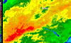
(see
24 hour national radar animation) also
(KILX Radar Animation from Friday 0000
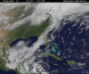
through Friday 1800). The following
2 day Satellite Animation shows
the impressive storm system as it pulled into the Missouri and Ohio Valleys.
The snowflakes reminded me of sand blowing on a beach. Extremely fine.
At times it appeared as if the snow was blowing horizontally down the street. It was difficult
to keep the snow out of the camera equipment and clothing. The winds were
gusting in excess of 35 miles per hour. Sustained winds were
between 20-25 miles per hour for several hours. I took shelter in a seven story parking garage to
protect my camera gear and to prevent myself getting too cold. I was able to get a few photographs from that
location. Wind chill values were below zero at times. This made for
difficult photography (to say the least). The wind seemed to funnel
through the garage at times and caused a roaring noise that resembled a
weak tropical storm.
At 5 a.m. the streets of Peoria were snow and ice packed.
They were virtually clear
of traffic with the exception of just a few motorists who "thought" it would be a good idea
to venture out onto the streets. I witnessed a number of cars that were
stuck in the snow with drivers waiting for tow trucks. I also observed a
number of abandoned vehicles in the streets of the downtown area. Snow was
starting to drift up and over the bumpers of cars parked alongside the street. Local officials
were urging people not to travel. It appeared that there would not be many
businesses opening their doors.
Visibility was less than two blocks during the height of the snow event (see
METAR data here and
here). Snowdrifts exceeded four feet in some locations in the
downtown area of Peoria. By 10 a.m. the snow had drifted up to the windshields
of cars parked on
several downtown streets. While walking I noted a few people trying to get
to their place of business on foot, having abandoned their vehicles. It
appeared that virtually everything was closed. During a two hour period I
counted less than twenty vehicles traveling the roadways. Snowplows were just
starting to get on top of the situation.
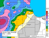
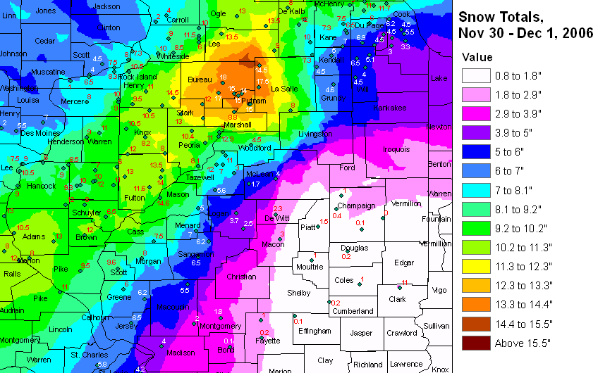
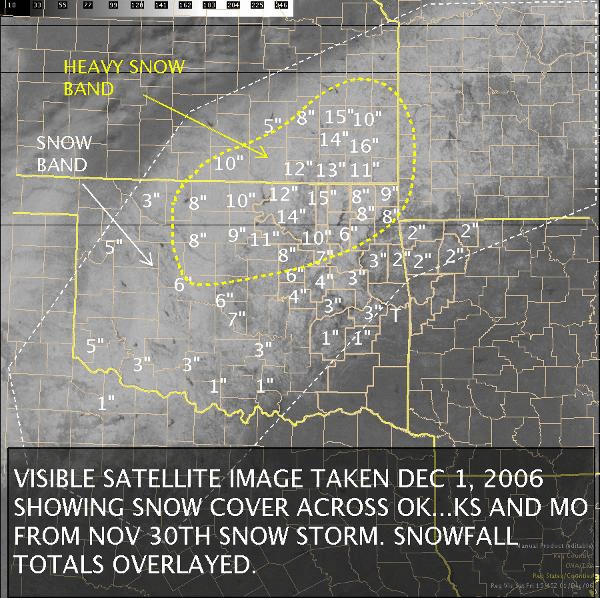
Snow ended around 11 a.m. After
all was said and done we had approximately 13-14
inches of snow in Downtown Peoria. Area measurements revealed a range from
6-14 inches. Amazingly there was a significant drop-off of snowfall
amounts as you traveled just a few miles south and east of the downtown area.
That area experienced more ice than snow.
For the rest of the morning the skies
remained mostly cloudy. A bit of sun did try to break through towards
mid-afternoon. Blowing snow was a problem through 3 p.m. The NWS
issued blowing snow advisories because of this. Temperatures did not
recover through the day and fell into the single digits during the overnight
period.
Peoria recorded a low of 4 degrees on the following morning! The snow pack
helped temperatures stay below normal for several days after the event.
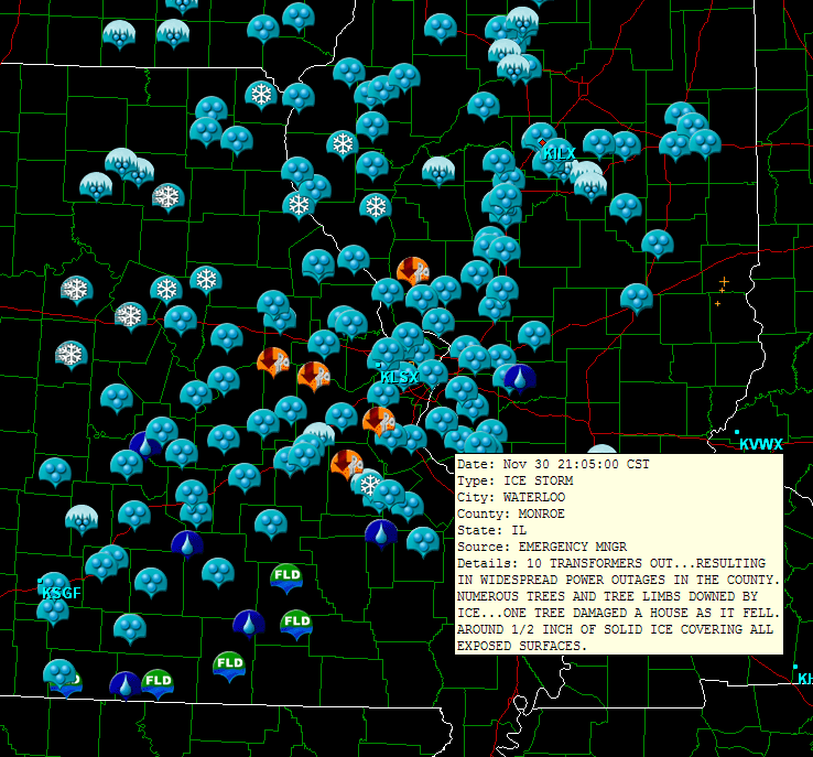
Although I was unable, regrettably, to experience the severe ice storm, in Central
Illinois, I did drive through some of the hard hit areas, on my way back to
Western Kentucky, on Saturday Morning. Photographs that I took show heavy
ice accumulation on trees and power lines. I would estimate the thickness
of the ice to have exceeded one inch in at least two counties. Severe tree
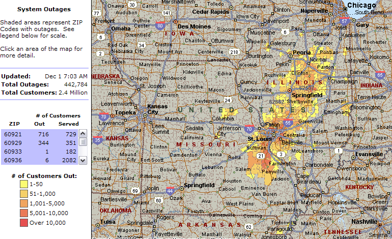
damage was noted. Large areas were also without power for over one week
following the ice storm. At one point more than two million people were
without power across the Central United States because of this powerful winter
storm system. I regret not spending more time photographing the ice event.
I kept two blogs on the event. Both of these are posted on the
EasternUSwx
forum. |
| |
| |
Blog 1 |
Blog 2 | |
| |
| |
|
Area Forecast Discussions |
| |
|
Lincoln,
Illinois NWS - Area Forecast Discussions |
|
St Louis,
Missouri NWS - Area Forecast Discussions |
| |
| |
|
Storm Prediction Center Mesoscale Discussions |
| |
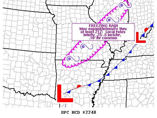
November 30 - 12:00 p.m.
Mesoscale Discussion |
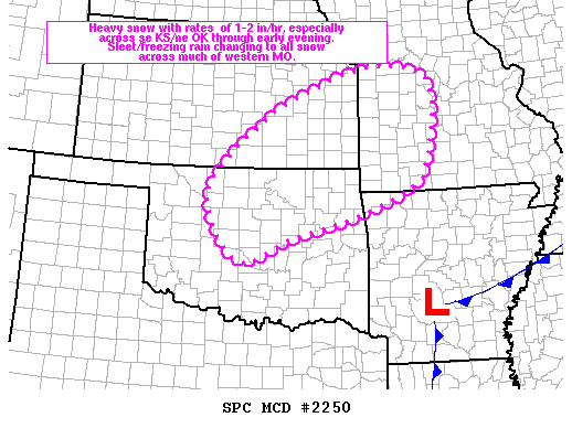
November 30 - 4:28 p.m
Mesoscale Discussion |
November 30 - 5:27 p.m.
Mesoscale Discussion |
November 30 - 11:50 p.m.
Mesoscale Discussion |
| |
|
|
| |
|
November 30th/December
1st - All Mesoscale Discussions |
|
|
| |
 12 a.m. 500mb Map
December 1 |
 7 a.m. 500mb Map
December 1 |
Noon 500mb Map
December 1 |
 6 p.m. 500mb Map
December 1 |
|
| |
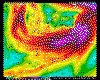
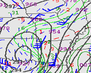
| December 01, 2006 Upper Air Analysis |
| |
|
|
|
|
|
|
|
|
|
|
| |
| |
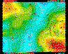
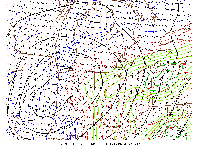
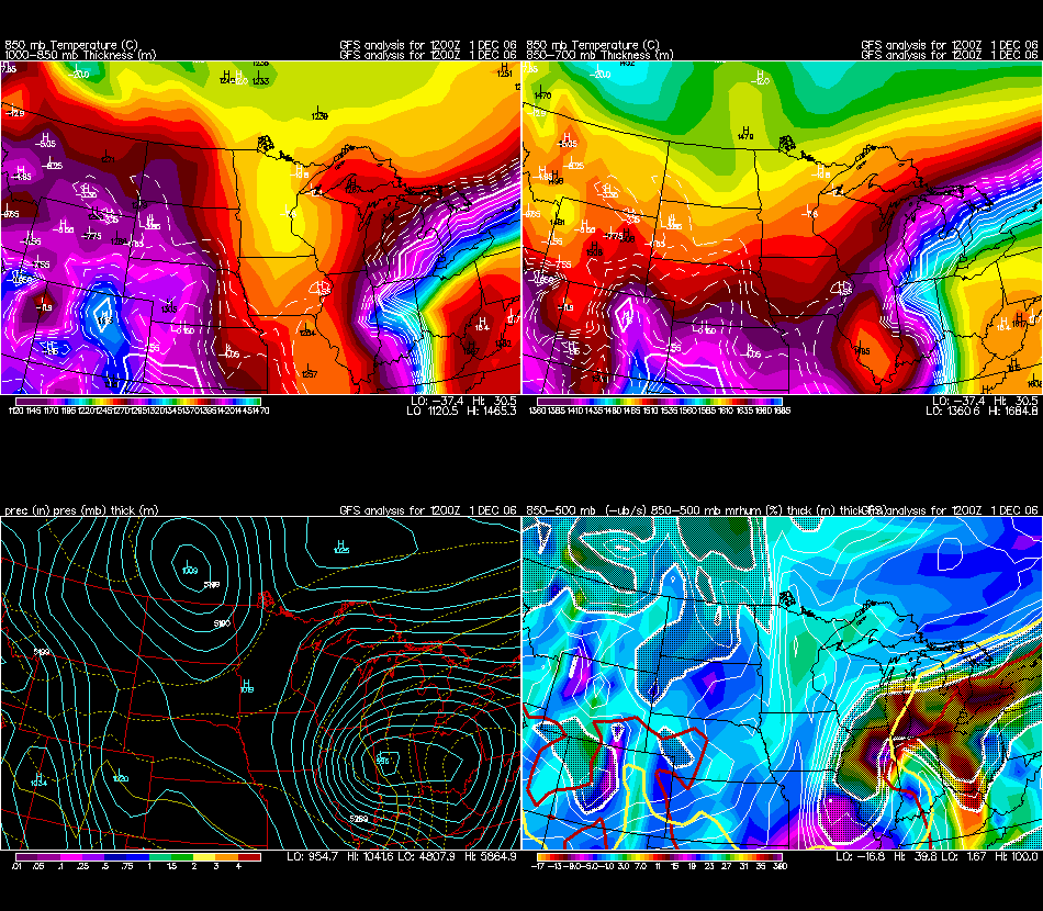
 1 a.m. 850 - 500mb -ub/s mrhum and Thickness |
 1 a.m. 850mb Temperature
1000-850mb Thickness |
3 a.m. National Radar Centered on Iowa |
 4:30 a.m. Thundersleet and
Snow across Central IL. |
|
| |
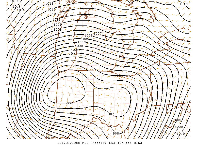
 Friday Morning
Surface Winds |
 5 a.m. Ohio Valley
Surface Map |

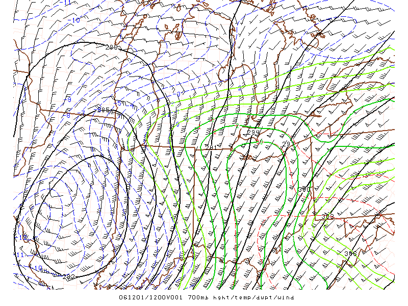
700mb Map showing the Dry Slot and Trowel |
 6 a.m. 850-500mb -ub/s RH and Thickness Chart. |
|
| |
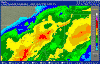
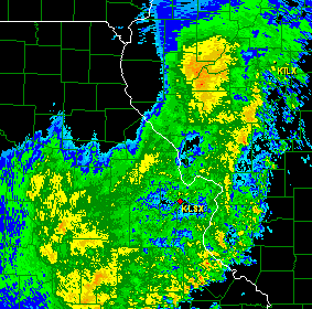
Large Illinois, Indiana, Michigan
Radar Map - 6 a.m. |
| |
| |
 7 a.m. SPC Surface Map |
 7 a.m. SPC 850mb Map |
7 a.m. SPC 700mb Map |
 7 a.m. SPC 500mb Map |
|
| |
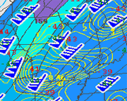
 4 Panel Midwest
Winter Maps |
 7 a.m. National 700mb
VV Chart |
3 Hour Pressure Falls on Friday Morning. |
 24 Hour National Radar
Animation |
|
| |
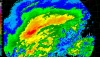
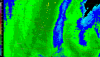
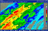
7 a.m. Central IL Radar. Banding over Peoria. |
7 a.m. Heavy snow falling in Peoria. |
8 a.m. Power Outage
Map for MO/IL |
Storm Pulling Away
from Illinois |
|
| |
Large Great Lakes Radar
Map - Noon |
| |
| |

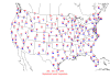
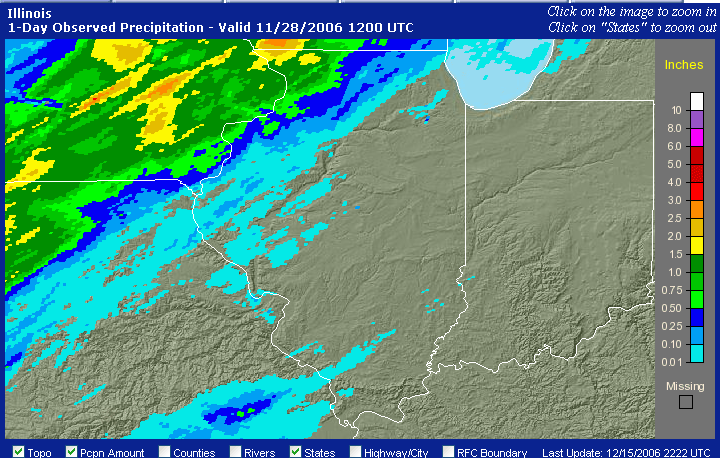
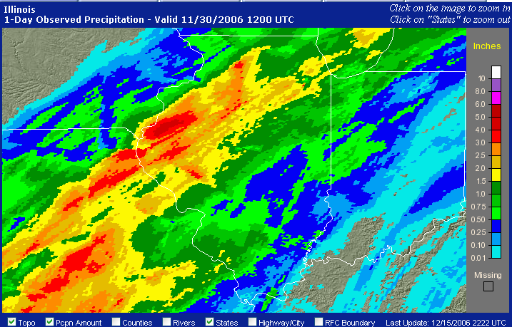
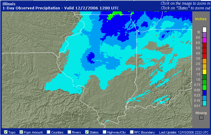
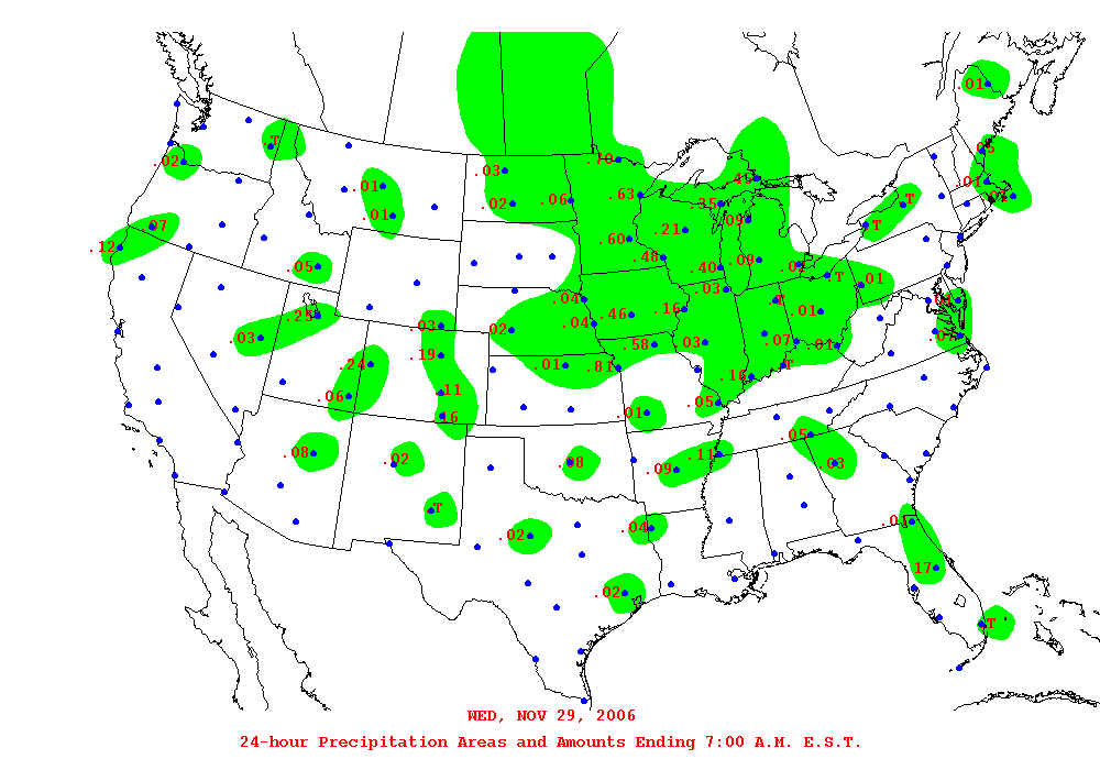
Nov. 28 MO/IL Precip Totals |
Nov. 29 MO/IL Precip Totals |
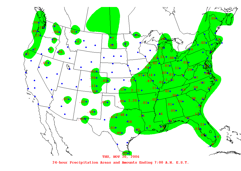
Nov. 30 MO/IL Precip Totals |
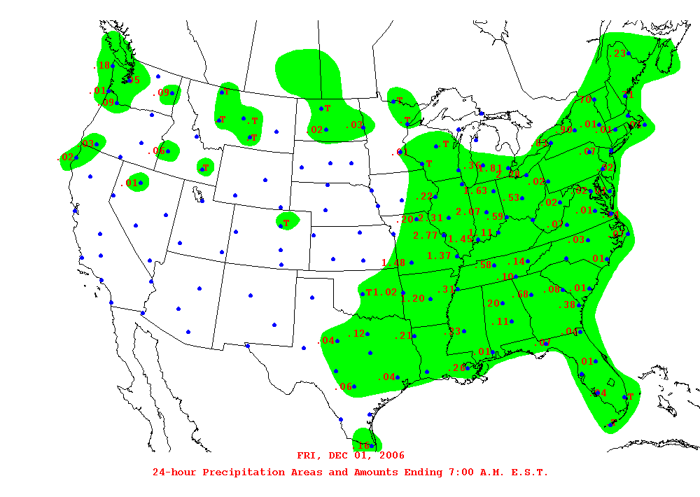
Dec. 01 MO/IL Precip Totals |
|
| |

December 02 MO/IL
Precip Totals |
Four Day Precipitation Totals
Animation |
|
| |
| |
|
St
Louis, Missouri - NWS Radar Animations |
| |
|
|
| |
| |
|
|
| |
| |
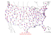
Nov. 29 MO/IL Precip Total Amounts |

Nov. 30 MO/IL Precip Total Amounts |

Dec. 01 MO/IL
Precip Total Amounts |
Dec. 02 MO/IL
Precip Total Amounts |
|
|
|
| Maximum and
Minimum Temperatures |
| |
Nov. 29 Max/Min Temperatures |
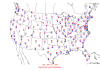
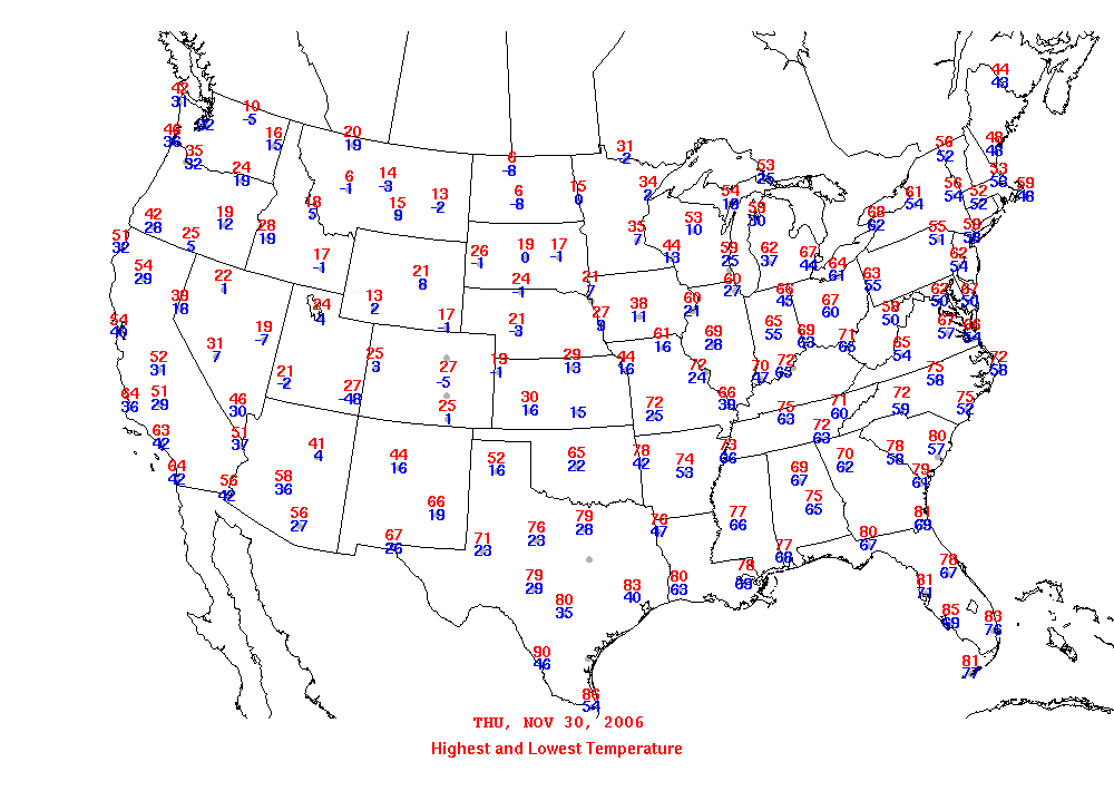
Nov. 30 Max/Min Temperatures |
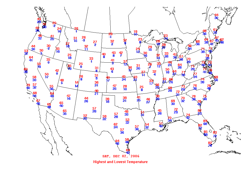
Dec. 01 Max/Min Temperatures |
Dec. 02 Max/Min Temperatures |
|
| |
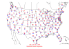
Dec. 03 Max/Min
Temperatures |
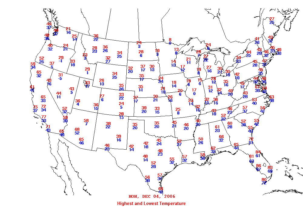
Dec. 04 Max/Min
Temperatures |
|
| |
| |
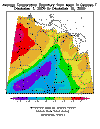
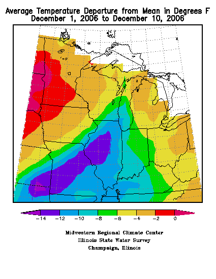
verage Temp Departure
from Mean - 12/1 - 12/10 |
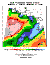
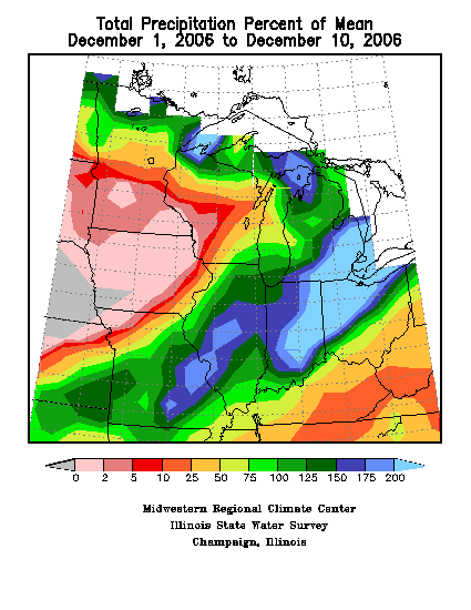
Total Precip Percent of
Mean 12/1 - 12/10 |
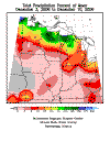
Total Precip Percent of
Mean 12/3 - 12/10 |
|
| |
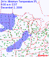
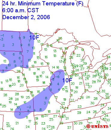
24 Hour Min Temperature
December 02, 2006 |
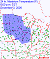
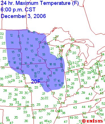
24 Hour Max Temperature
December 03, 2006 |
|
| |
|
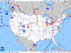
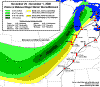
Snowfall Accumulation Maps --
NWS |
| |
| |

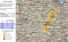
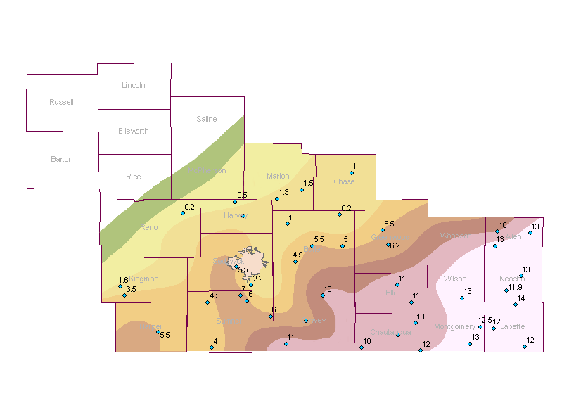
Snowfall and Ice Map
Image provided by Wichita, NWS |
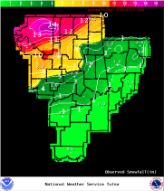
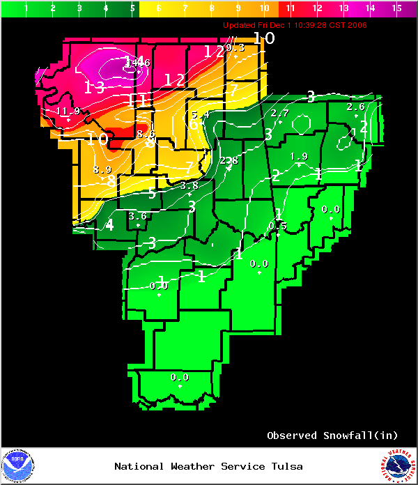
Snowfall and Ice Map
Image provided by Tulsa, NWS |
|
| |
Snowfall and Ice Map
Image provided by St Louis, NWS |
Snowfall and Ice Map
Image provided by Lincoln, NWS |
|
| |
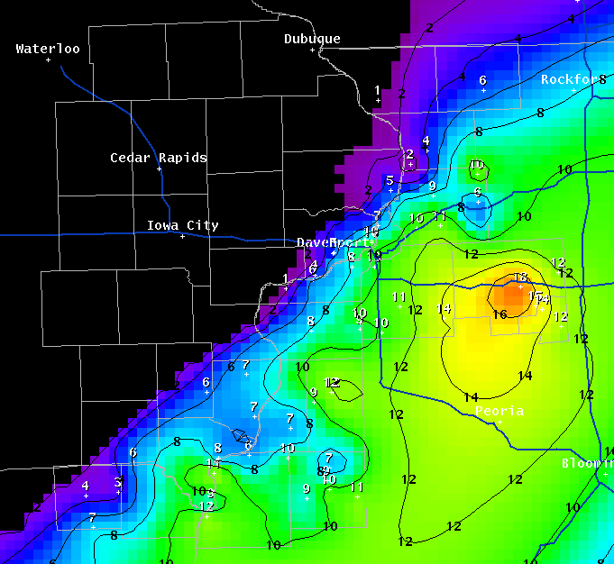
Snowfall and Ice Map
Image provided by Quad City, NWS |
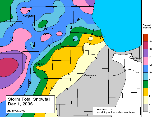
Snowfall and Ice Map
Image provided by Chicago, NWS |
|
| |
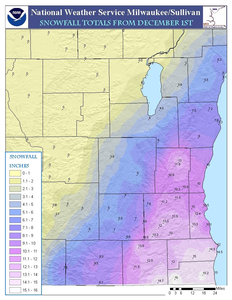
Snowfall and Ice Map
Image provided by Milwaukee,
NWS |
Snowfall Totals
Regional Google Image |
|
| |
Milwaukee, NWS
Storm Track Map |
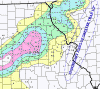
KILX 3 Day Precip
Total Map |
|
| |
| |
|
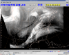
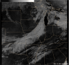
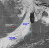
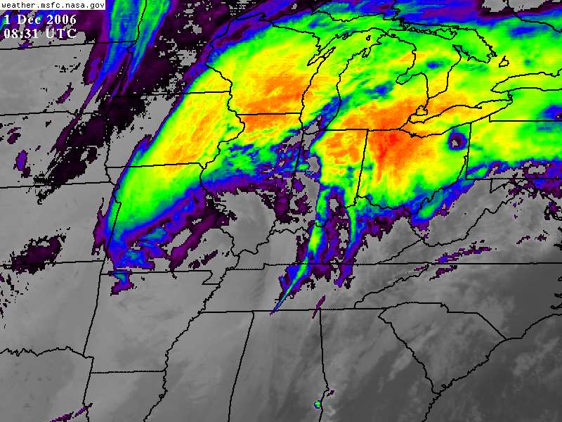
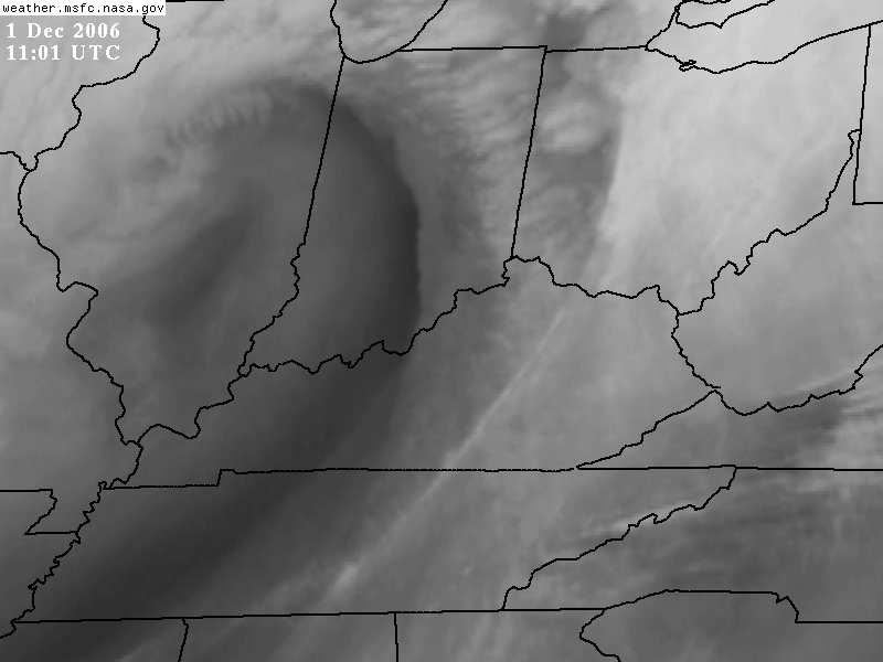
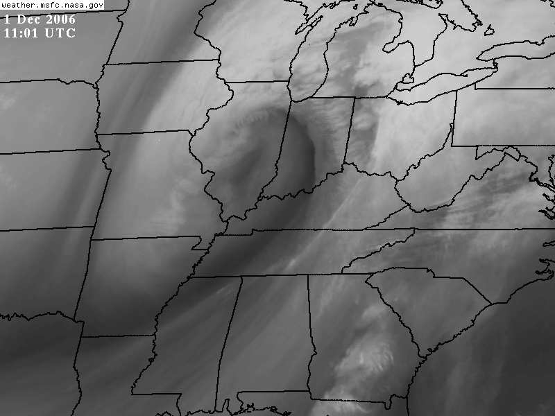
Satellite Images --
NOAA |
| |
|
Two Day Satellite Animation |
| |
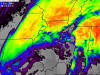
Ohio Valley Enhanced |

Color Enhanced |
|
| |
Large Northern Hemisphere
WaterVapor Image |
Enhanced Water Vapor Image |
|
| |
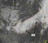
 Central U.S. Zoomed
Water Vapor |
Illinois Water Vapor |
|
| |

Ohio Valley Water Vapor |

Eastern U.S. Enhanced |
|
| |
Michigan Water Vapor |

Northeast U.S. Thunderstorms |
|
| |
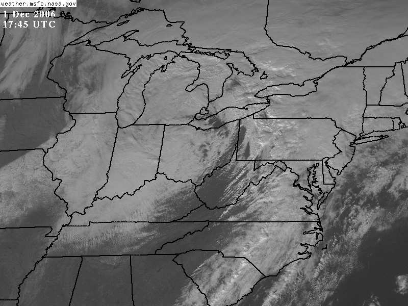
Eastern U.S. Morning Visible |
NOAA Goes 12 Enhanced |
|
| |
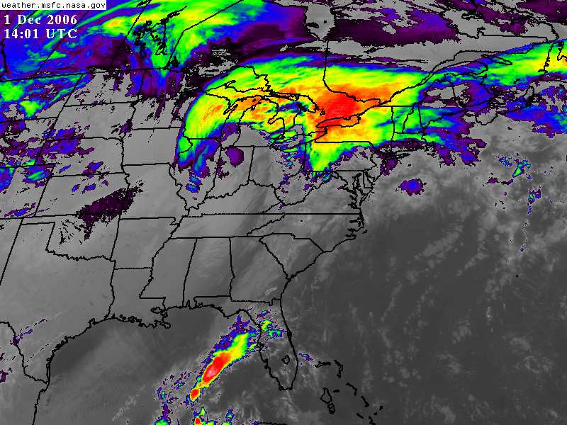
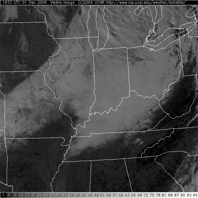
Modis Image |
 Visible Image |
|
| |
Milwaukee NWS |
 Ohio Valley Image |
|
| |

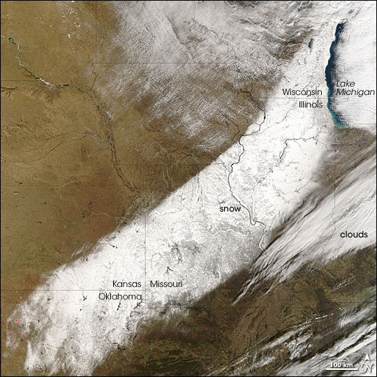
Visible Image of Snowfall |
 Wichita, Kansas, NWS
Visible Imagery |
|
| |
Springfield, MO - NWS
Visible Image and Notes |
Tulsa, OK - NWS
Visible Image with snow totals |
|
| |
|
Other Storm
Analysis Pages |
| |
|
Lincoln, Illinois, NWS
Analysis |
|
St Louis, Missouri, NWS
Analysis |
|
Midwest Climate
Watch |
|
|
|
Top of Page |
|
|
|
General Storm Evolution | Daily Highlights |
Snowfall Total Maps |
Satellite Imagery |
| |
|
Back to Weather Photography Home Page |
| |
|
Page design inspired by cimss.ssec.wisc.edu |
|
Please alert me to any errors on this page. |


